

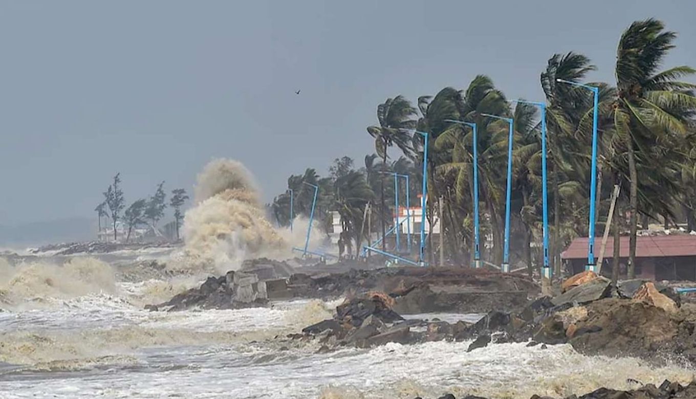
Saturday, 4th December: Andhra Pradesh and West Bengal are going to experience heavy rainfalls as earlier predicted by India Meteorological Department. Rain has already started in Odisha which is the closest location to Cyclone Jawad as it is arriving from the west-central side of the Bay of Bengal.
ODRAF, NDRF, and 247 teams of State Fire Service have speeded up the process of evacuation on the coast.
#WATCH | Odisha: Lifeguards from the Odisha Fire & Disaster dept urge people to vacate Puri beach, in the wake of #CycloneJawad pic.twitter.com/SAM9nt7DUH
— ANI (@ANI) December 4, 2021
Around 20 teams are reserved for emergencies and schools are closed in 19 districts including the capital city Bhubaneshwar.
As per IMD, cyclone Jawad is gaining a speed of 70-80 kph and will reach 90 kmph by tomorrow. This will result in heavy rainfall but would not convert into a severe cyclonic storm.
Also Read: India Reports 2 Omicron Covid Variant Cases In Karnataka
IMD Predicts ‘Heavy’ To ‘Very Heavy Rain’ In These Areas

via:latestly
Cyclone Jawad will move northwards and gain intensity while heading towards West Bengal bringing rainfall to nearby areas too. The weather department has predicted heavy to very heavy rain in Paschim Medinipur and Purba whereas Howrah, Hooghly, Jhargram, and South 24 Parganas will get heavy rain by Sunday.
The effect of Cyclone Jawad will be seen on Monday too in Murshidabad, Nadia, and other areas of West Bengal. IMD also warned Tripura, Assam, and Meghalaya as these places may get heavy rainfall as per the prediction.
Andhra Pradesh has also started preparation to deal with Cyclone 11 NDRF, 5 SDRF, 6 coast guards, and 10 Police Squad are operating in Vishakapatnam, Srikakulam, and Vijaynagram. So far, 54 thousand are safely been removed from the area.
Odisha CM Requests People ‘Not To Get Panic’
As #Odisha braces up for impending #CycloneJawad, urge everyone to follow scientific advisories and safety measures. Restrain from rumours and do not panic. Follow advisory & cooperate with administration to keep you and your family safe. #OdishaFightsJawad pic.twitter.com/gSwq8pt146
— CMO Odisha (@CMO_Odisha) December 3, 2021