

Belize coral reef home to Great Blue Hole is at risk due to sea level temperature rise. NASA’s Jet Propulsion Laboratory and the team of researchers used 20 years of satellite data and free cloud-based data on Google Earth Engine for their analysis of the barrier reef system.
Belize’s coral reef is at risk due to climate change. Scientists are taking the help of NASA satellites to evaluate the current situation.
Belize barrier reef is one of about 1,200 UNESCO World Heritage sites around the world. Belize coral reef sites are currently facing the danger of bleaching and collapse.
NASA and the government of Belize taking strict action to protect it.
Belize Coral Reef System

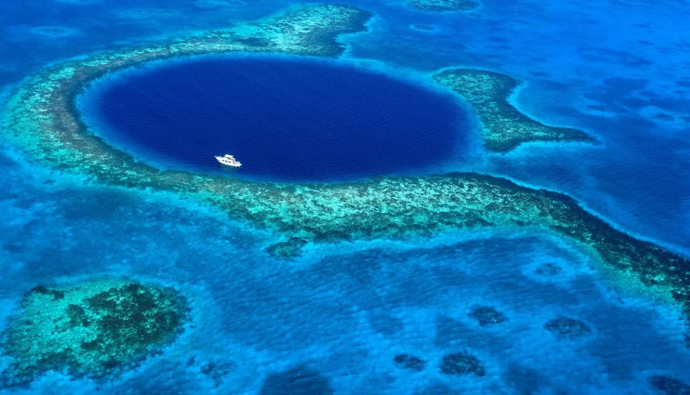
Belize coral reef system with famous Great Blue hole
The Belize Barrier Reef is the beauty of Belize and is located at the coast of Belize of Central America.
Belize’s barrier reef system is 298- kilometer-long located on the coast of Belize that supports thousands of animal and plant species.
It drives the country’s largest tourism. It is a part of Central America’s biodiversity program.
The coral reef consists of stony coral. Which keeps the water calm and clear. The symbiotic algae live in the coral and provide food. When algae die they lose color this process is called bleaching.
But due to climate change, the temperature of water rises and salinity also increases which risks the Belize coral reef.
NASA’s Satellites and the Govt. of Belize Help to Assess the Situation of Belize Coral Reef
Emil Cherrington, a native Belizean, who is a research scientist at the University of Alabama in Huntsville and also a co-investigator on the Belize Sustainable Development Goal Project said – “We depend on the reef for so many things, so conserving these resources is important. Studies like this are giving the government of Belize more tools for conserving the resources that the country has.”
Scientists use NASA’s Moderate Resolution Imaging Spectroradiometer (MODIS).
MODIS – a satellite-based sensor, to assess the situation of Belize barrier reef data. It was developed at NASA’s Goddard Space Flight Centre in Greenbelt, Maryland and launched in 2002 with NASA’s Aqua satellite.
MODIS collects data on water clarity and temperature over large areas.
Scientists collect the images from the MODIS of the Belize coral reef system. Scientists analyze these images and divide the area of the Belize barrier reef into the vulnerability index.
Scientists Divided Belize Coral Reef into the Vulnerability Index
24 marine protected areas ranked in the study of the Balize barrier system. Image credit: NASA/JPL, Caltech
The scientists ranked 24 those of the marine protected area off the Belize coast, which is based on the risks corals face from untidy water and rising temperature.
Scientists after analyzing these images develop a vulnerability index for the risk-associated area of coral reefs in the marine environment.
Scientists after examining the sea surface temperature in each protected area and assigned a number from 1 to 6 based on how low or high the averages were relative to the norms.
They also give ratings for water clarity, they assigned 1 to 6 to the less risk area and a higher number signifies greater risk.
Based on this assessment Port Honduras Marine Reserve a 156 square-mile protected area in southern Belize, got the highest vulnerability score: 10 out of 12.
Other vulnerable areas are Swallow Caye Wildlife Sanctuary, Sapodilla Cayes Marine Reserve, and Corozal Bay Wildlife Sanctuary.
What Steps Belize City is Taking to Protect the Coral Barrier Reef?
Belize coastal zone management plan framework to guide Belize’s government on how to support the sustainable use of the country’s coastal areas.
The country’s coastal zone management Authority & Institute is tasked with implementing and monitoring policies that govern Belize’s coastal areas.
NASA’s Earth Applied Science program will also be making the next plan for protecting the Belize coastal area.
Belize’s coral reef is rich in biodiversity and provides a home to many marine animals and plants. Climate change causes the temperature rise of seawater and man-made pollution increases the turbidity of water.
The collective work of both NASA’s satellites and the local authority will help to protect the Belize coral reef barrier from the risk of extinction.
Also Read: NASA Perseverance Rover: Drifting Clouds are Seen on Mars